My 1st experience with geofencing for drones was a disaster. My lack of knowledge about geofencing and how to unlock the geofence caused me to lose my first drone job. It was definitely a lessons learned. Hopefully, this article will keep you from losing any jobs.
Geofencing for drones is used to enforce FAA-restricted airspace. The drone uses GPS to compare your location with predefined GPS-restricted areas. The geofence is administered by the drone vendor and does not allow the drone to enter into or take off in restricted airspace.
This article reviews details of geofencing in drones and how to unlock the vendor geofences so you can access restricted airspace.
What is Geofencing
The Federal Aviation Administration (FAA) has designated certain areas as drone no-fly zones. These areas include airports, military bases, and national parks. It is important to be aware of these areas to ensure you are not breaking any laws or regulations. For details on “no-fly” zones see our article “Drone No-Fly Zones: A Complete Review“
Geofencing is a drone safety measure that uses GPS or radio frequency technology to create virtual boundaries. This helps prevent drone flights in areas where drone operations may be restricted or prohibited due to safety or security concerns.
How Does Geofencing Work
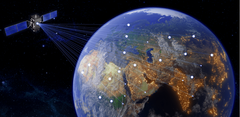
Geofencing uses GPS coordinates to define restricted areas and to geolocate your drone. When a drone enters a geofenced area, it will automatically be alerted to any restrictions.
Geofence is implemented by software that resides on your drone. The software is preset with a set of GPS coordinates that are compared with the location of your drone. This software has a preset with a number of responses if you get close to the fence boundary. The drone may simply stop and hover, it may return to home here, or it may land where it is.
The software gets updated periodically to ensure that the geofences are up-to-date.
Types of Geofenced Zones
DJI defines a number of geofenced zone types. You’ve probably encountered some of these.
Restricted Zone
Restricted zones are areas where drone flight is prohibited for safety and security reasons. This includes airports, prisons, power plants, military installations, and other sensitive locations that have restricted drone access.
In these zones, you will receive a notification and you be unable to start or take off in this zone. To operate in a restricted zone requires a waiver submitted to DJI via email flysafe@dji.com or online
If you get too close to one of these zones, the drone will either stop/hover or the drone may force-land.
Altitude Zone
Altitude zones are areas where drone operations are limited by altitude. The drone will be able to take off, but it won’t be able to fly higher than the restricted altitude. The restrictions apply to drone flights that have been granted permission to fly. This way pilot doesn’t accidentally fly too high and enter restricted airspace.
Authorization Zone
Authorization zones are areas where drone operations require additional approvals. Users can self-unlock this authorization in the form of a registration number or user identity with a DJI-verified account. The drone will take off, and prompt you with a warning.
Enhanced Warning Zone
Enhanced warning zones are areas where drone operations require additional caution. When entering the zone, you will receive a warning. You must manually unlock the zone and confirm that you wish to continue flying.
Warning Zone
These zones may not necessarily appear on the DJI App map. When the drone enters one of these zones, an alert is sent to the drone pilot reminding them of the potential risks. The drone will be able to continue its flight.
Regulatory Restricted Zones
These are prohibited areas created by local authorities. Examples include prisons and mental facilities.
Why Are Geofenced No-Fly Zones Important
Geofence zones are important because this is practically what will keep you from flying your drone. While the government defines restricted airspace they have no means to keep you from flying in those zones. The FAA can only catch you and penalize you after your flight. Because geofencing resides on your drone, it prevents you from flying your drone.
Be aware, even if you’re able to obtain FAA authorization to fly in a restricted area. You still have to apply for a separate geofencing authorization through your drone vendor. For more details on getting FAA authorization, see our article “How To Fly A Drone in Restricted Airspace“
Which Drone Vendors Have Geofencing
DJI was the first to introduce a geofencing system in 2013 with their no-fly zone map. So all DJI drones will come with geofencing. Other drone vendors have since followed suit with their own geofencing systems. Currently, drone vendors like Autel Robotics and Parrot also have geofencing.
Geofence Zone vs. FAA Airspace
The FAA defines several categories of airspace for drones. Controlled, special-use, and temporary flight restrictions (TFRs) are the categories that restrict drone flights. The air traffic authority manages Controlled airspace. The government manages Special-use airspace for national security and sensitive infrastructure. TFRs are restricted areas defined for a limited amount of time for hazardous flight conditions or special events.
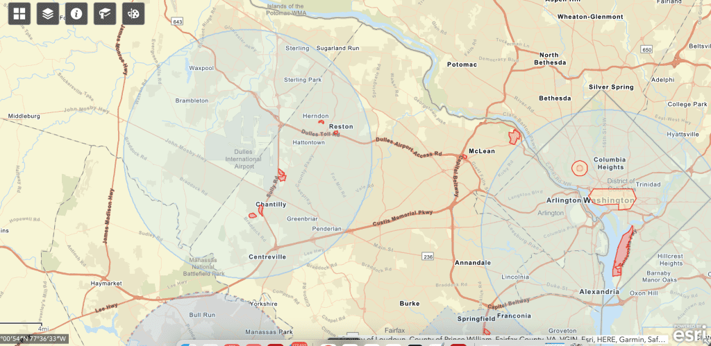
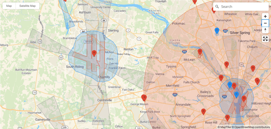
Geofences integrate with special use and controlled airspace to define boundaries. The geofence does not generally reflect TFR status so it’s important that you check the FAA website for TFRs.
Geofence Access vs. FAA Authorization
To unlock access to the geofenced area you have to submit a waiver to the vendor. This waiver is needed in addition to the FAA airspace waiver. There are two types of geofence unlock waivers: Custom Unlock and Self Unlock. The self-unlock application is submitted via compute or phone.
Submit the custom unlock application to the DJI website. The submission requires proof of flight authorization from the FAA. You should apply for custom unlock authorization well before your mission because it can take several hours. So don’t expect to get a Custom Unlock while on-site.
When you start your mission the control software will request your unlock authorization before enabling drone startup.
How To Unlock DJI Geofence
DJI drones comprise the majority of geofence systems. We will focus on this DJI process. The custom-unlock and self-unlock processes are very similar and outlined in the sections below. Alternatively, you could follow our video tutorials.
Perform Custom Unlock
Log into your DJI account at the DJI’s Unlock site.
Select “Unlocking Requests” and enter the requested information. My first time it took me a while to figure out how to find the flight controller serial number (it is not the drone serial number). I linked to a short video that may save you some time.
Select the geographic area you want to unlock and enter mission details (flight radius, altitude). Then confirm the information is accurate.
How To Fly A Drone in Restricted Airspace
DJI should respond to your submission within 1-hour via email. You can also check the status of your submission on the website.
When you start your mission, you’ll need to upload the authorization key to unlock the drone. Then you should be good to go. Note: you will need an internet connection to complete this process.
Contact DJI support at flysafe@dji.com if you have any problems.
Perform Zone Unlock From Home
Log into your DJI account at the DJI’s Self Unlock site.
Follow the same initial procedures as above but select “Self Unlock” versus “Custom Unlock”. Enter your mission information. The mission date is important because the unlock is only valid for 72 hours.
Agree to the terms and conditions, then verify your identity on your DJI account. You should see a popup indicating ‘Verification Complete’.
After getting the unlock approval you’ll need to upload the flight license to the DJI GO app in “General Settings” under “Unlock List”. This will require an internet connection.
Perform Self Unlock On Site
This is much easier to do using the DJI GO app at the mission site. I recommend you use this method.
Open the DJI Go app. Click “Yes” in response to the flight restriction warning. Verify your identity on your DJI account and select “Confirm” for self-unlock.
How To Find Your Flight Controller Serial Number
- Connect to the DJI Go 4 app with the controller and your drone.
- In the top right corner, click on the three dots for General Settings.
- Scroll to the bottom, click on About, and your serial number will appear there
Benefits of Geofencing for Drones
Protect Drone Users
Geofencing for drones offers drone pilots peace of mind when it comes to flying in areas that may have restricted airspace or other safety considerations. With geofencing, drone pilots are able to quickly identify no-fly zones and avoid them, ensuring that their drone does not enter any restricted airspace.
Perfect example, there was a guy who just bought a drone and decided he’d take it for a flight in downtown DC. No malicious intent, but also no knowledge of drone rules and regulations. He hadn’t even registered the drone. Fortunately for him, the geofence disabled the drone which probably saved him from some serious trouble (no this was not me).
Protect Public Privacy
Drone pilots can also benefit from geofencing by preventing flights over sensitive areas, such as prisons, and military bases. Sometime private geofences will protect private property. Drone geofencing technology, protects the privacy of people in these areas and ensure that drone flights are conducted responsibly and safely.
Drawbacks of Geofencing
Complicates Drone Missions
My first experience with geofencing was my first drone job supporting a real estate agent in Washington DC. I obtained the appropriate FAA flight waivers, but when I showed up at the site to do the job my drone would not start.
This was a time-sensitive operation and I ended up losing the job – lesson learned. The additional authorization process required for geofencing does create more work for professional drone pilots.
Vulnerable to Hacking
Because the geofence relies on GPS signals it is vulnerable to GPS spoofing. This is a form of drone hacking that sends bogus GPS signals to your drone. For a detailed discussion, on GPS spoofing see our article “Is It Possible To Hack a Drone?”.
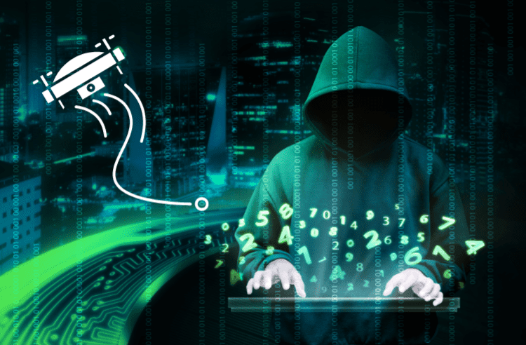
This will be an important issue for future drone systems that will rely on geofences to support UAS Traffic Management (UTM) systems. Compromiing these systems will create havoc in low-altitude airspace.
Restricts Pilot Autonomy
Many pilots have the philosophy “fly free or die”. And they will chafe against any restriction on how or where to fly their drone. I understand this feeling. For those of us that have taken the time to learn and abide by the rules and regulations we feel like we can make our own decisions about where to fly. But I also acknowledge that there are a lot of idiots out there that need the restriction.
Limits Time Sensitive Missions
Drones are often used by first responders and law enforcement in time-critical missions. For example, search and rescue, or tracking down a violent criminal. In these cases, there’s no time to apply for flight waivers. Typically first responders and law-enforcement agencies have certificates of authorization (COA) in place which allow them to fly in restricted areas if necessary. However, they are still restricted by the geofence and need to go through the entire authorization process.
Recommended Drones Without Geofencing
Autel Evo II
PRICE: $2500 (New with accessory bundle) | $1099 (refurbished)
Wt: 1.13 kg | Max Flight Time: 40 min | Wind Resistance: 12 m/s
Photo: 48 MP | Sensor 1/2″ CMOS | Lossless Zoom: 4x | Video: Up To 8K
The Autel Evo II drone opertes to a maximum altitude of 15,000 feet and has a range of 6 miles (please do not fly your drone up to 15,000 feet and do not fly out to 6-miles). The drone has a 48MP camera and offers up to 40 minutes of flight time, which is impressive.
GDU 02
PRICE: $732
Wt: 1.56 kg | Max Flight Time: 23 min | Wind Resistance: —
Photo: 13 MP | Sensor: 1/3″ | Lossless Zoom: — | Video: –
The GDU 02 drone is a popular drone for both recreational and professional use due to its affordability and ease of use.
Frequently Asked Questions
Can I circumvent geofence by flying in ATTI mode (GPS turned OFF)?
I have tried this, and flying in ATTI did not turn circumvent geofencing. This appears to be because the GPS signal is still being received, it’s just not being used by the drone to help with flight control.
Can I circumvent the geofence by wrapping the drone in foil to block the GPS signal?
Being a communication systems engineer, the solution made sense to me. However, I tried it and it did not circumvent the GPS signal. This is probably because the GPS signal is received from multiple paths. Also, any small lack of integrity in your foil will allow the signal to reach your receiver. It’s impossible to completely cover your drone in foil because you don’t want to impede your air intake vents or propellers.
Can I hack my drone operating system to remove geofence?
It is possible to modify your drone’s operating system and modify the firmware to remove geofencing or generate bogus unlock certificates. There is a website that provides instructions and techniques to modify drone operating systems. I do not endorse this site nor do I recommend doing this. The drone systems are very complex, and unless you are extremely knowledgeable in software design and operating systems you can do serious damage to your drone software. In addition, this may invalidate your drone warranty. Of course, you can’t call DJI and ask how this ould warranty. That’s like calling the bank and asking, hypothetically, what would be the best time to rob a bank.
Conclusion
Geofencing for drones is a necessary evil to protect both drone pilots and public airspace. This technology will become even more important as the number of drones and drone application increase. Understanding geofences is important for safe and responsible drone operation. For details on starting your drone business, see our article “First 9 Steps To Start A Drone Business“
Lightwave Aerial is a professional drone service company based in Northern Virginia. Our pilots are all FAA Part-107 certified. We offer a full range of aerial photo/video production services, aerial mapping, and aerial inspection.
At Lightwave Aerial, we are dedicated to providing professional drone services that help our clients achieve their goals. Contact us today to find out more about how we can help you with your next construction project!

